The GeoSafe Platform

Flood and Climate Exposure Screening Tools

An integrated platform of analysis tools built on Canadian terrain data, advanced flood exposure modeling, and decision-support reporting — all in one place.

Tools to support early-stage risk review

Four integrated analysis modules work together to give you a clearer view of potential flood exposure and infrastructure context.

Flood Analysis

Flood Exposure Analysis

Analyze terrain, rainfall, and environmental data to identify areas that may be susceptible to flooding.

Building Screening

Building Exposure Screening

Screen buildings using terrain, hazard, and property information to support exposure review and planning decisions.

Infrastructure

Infrastructure Assessment

Review roads, bridges, culverts, and utilities that may be exposed to flooding and require further assessment.

Climate

Climate Scenarios

Compare current conditions with future climate scenarios to support long-term planning and climate resilience.

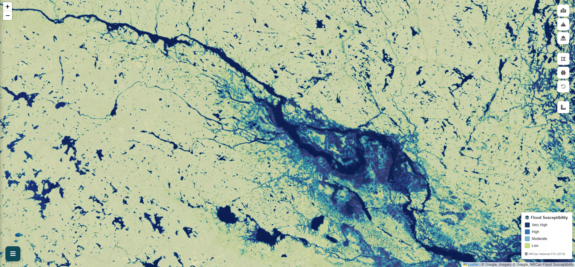
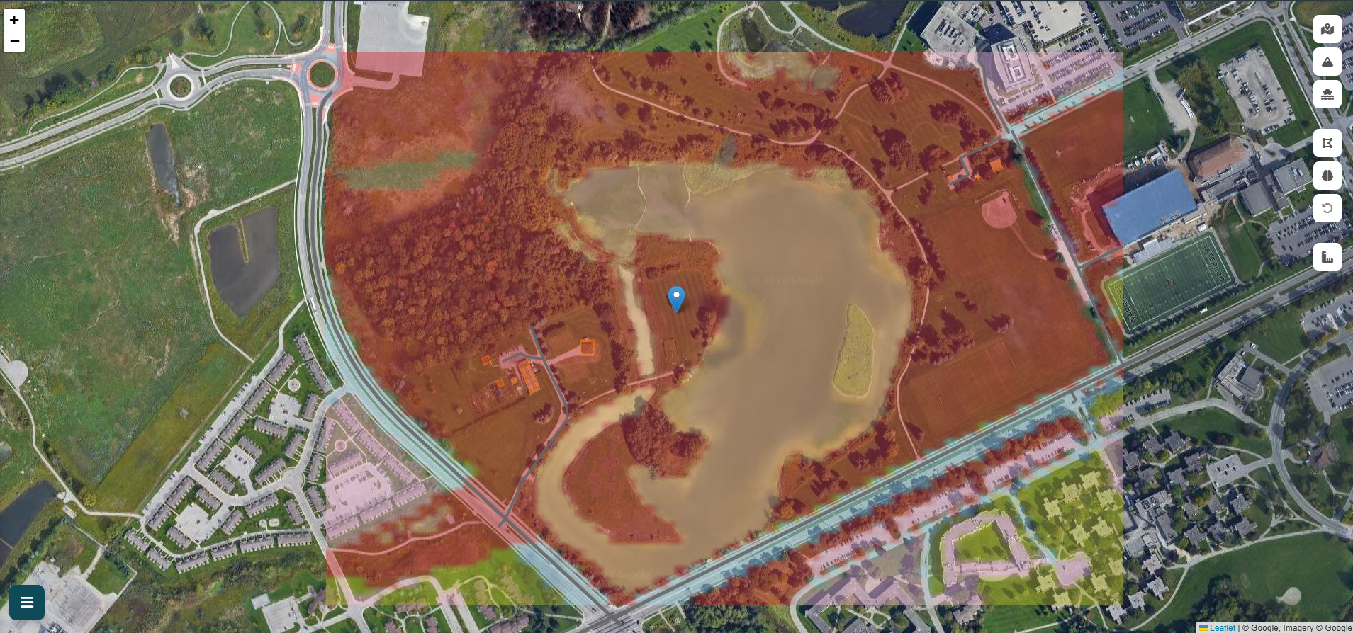
Flood exposure analysis and mapping

See how GeoSafe analyzes terrain and environmental data to identify areas that may be susceptible to flooding across Canadian locations.

Flood Simulation Animation

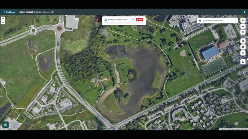
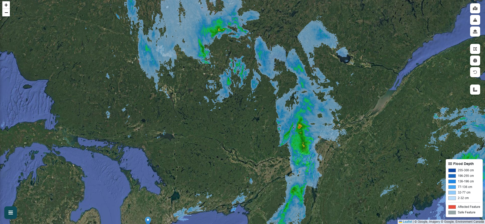
Watch the flood propagate in real time

GeoSafe analyzes available terrain and environmental data to help identify areas that may be susceptible to flooding and water accumulation across Canadian locations.

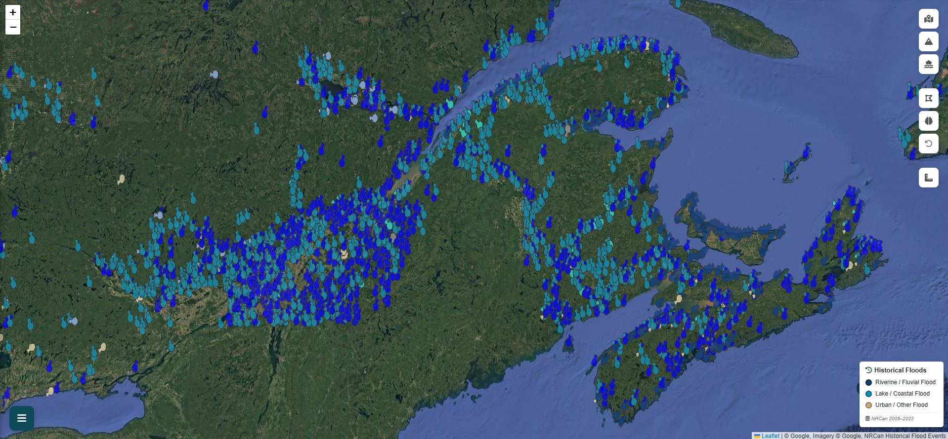
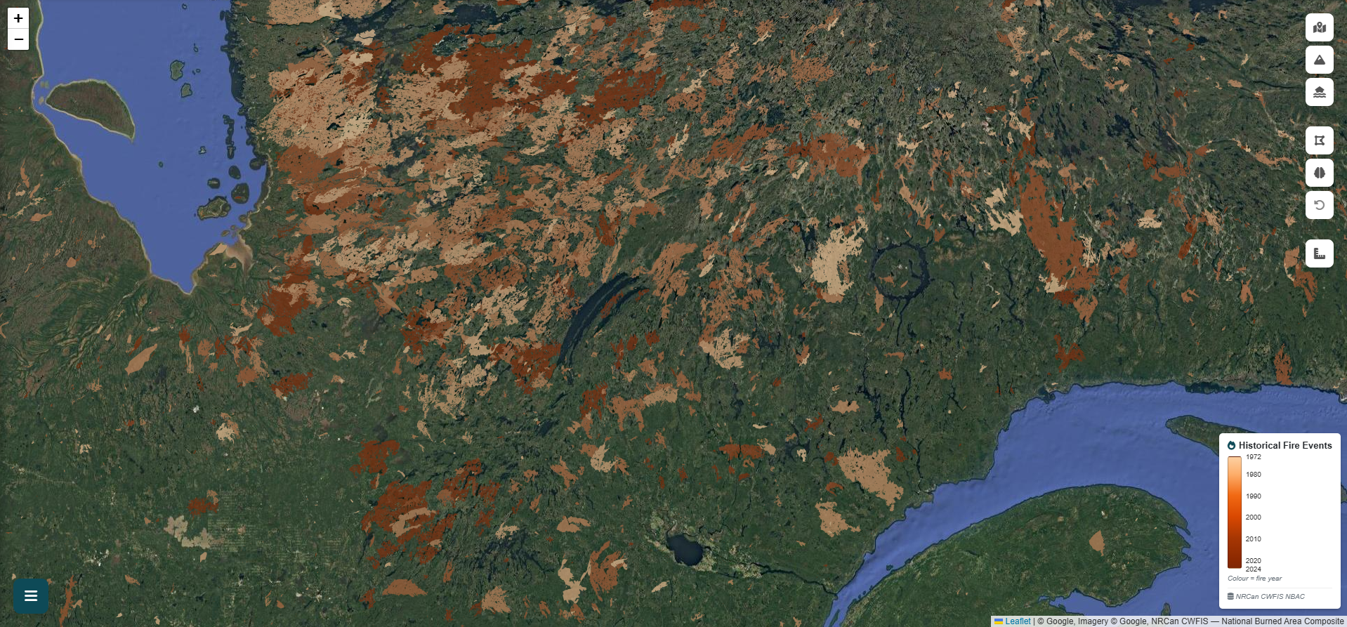
Terrain data — auto-downloaded
Publicly available elevation data sourced automatically for your study area.
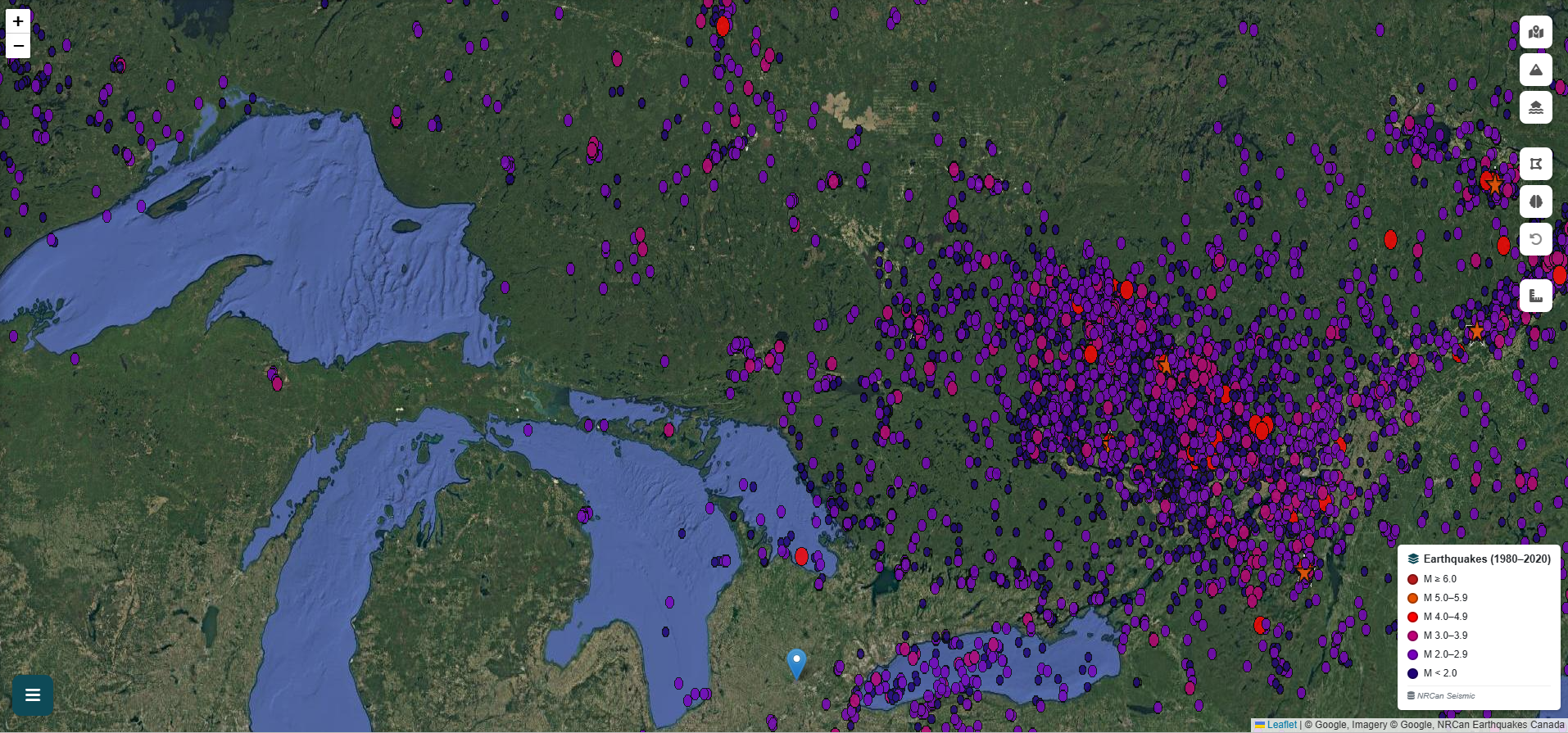
Weather and rainfall inputs
Canadian weather data integrated to support scenario-based flood exposure analysis.
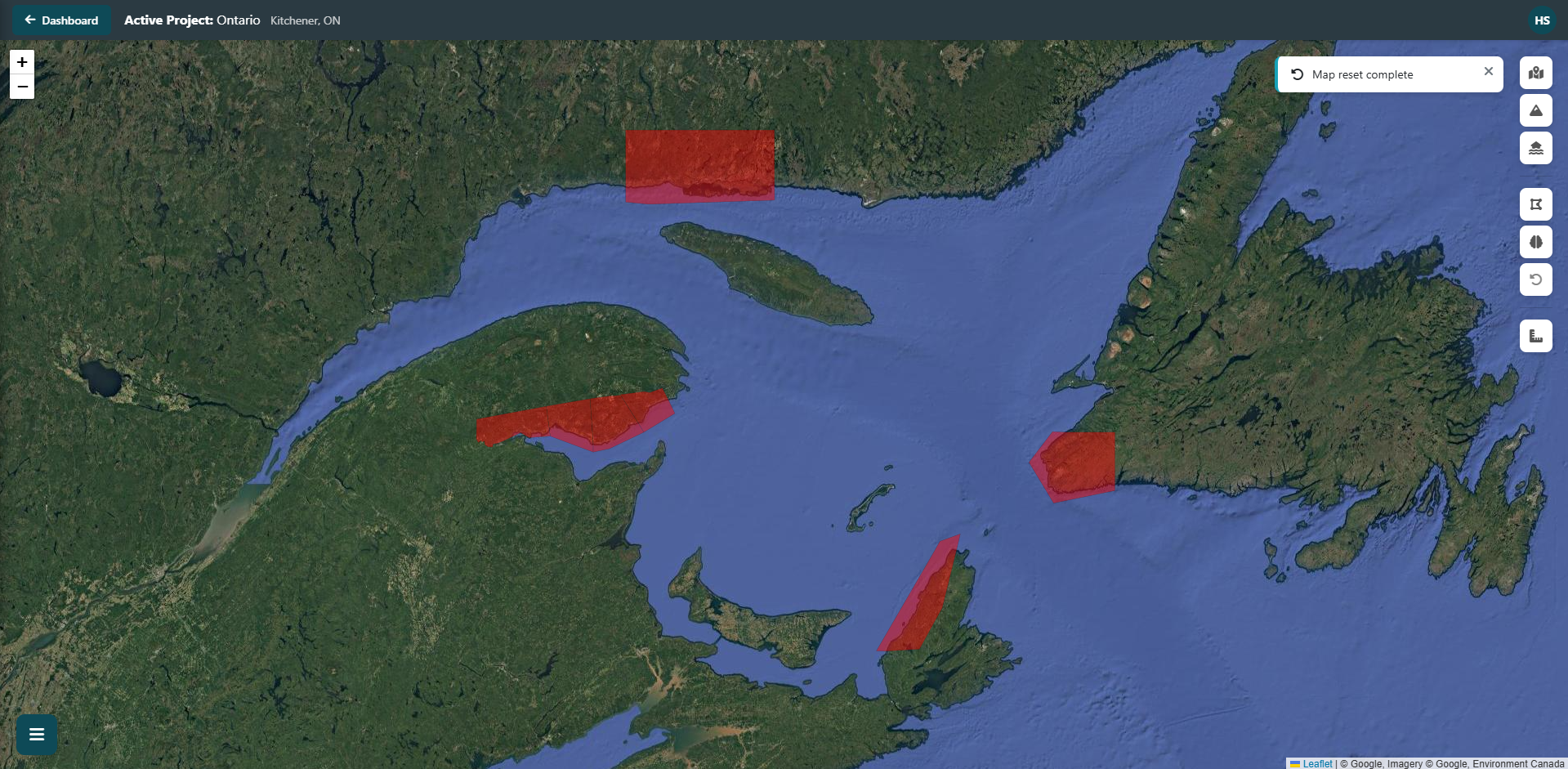
Building-level exposure screening
Publicly available depth-impact methods applied to screen exposed structures.

Built on publicly available Canadian data

GeoSafe integrates publicly available Canadian government data sources — terrain, weather, hazard, and infrastructure datasets sourced for your study area.

Canadian Terrain Data Environment Canada GeoMet OpenStreetMap AWS Terrain Tiles NRCan Flood Susceptibility Index
High-Resolution Terrain Data

Publicly available elevation data sourced from Natural Resources Canada for accurate flow direction and water accumulation analysis.

Advanced Flood Exposure Analysis

Terrain and environmental data combined to model surface runoff and identify areas that may be susceptible to flooding and water accumulation.

Exposure Classification

Data-driven risk classification using Canadian flood and hazard datasets to screen exposure at the property level.

Depth-Impact Assessment

Preliminary impact indicators using publicly available depth-impact methods for residential, commercial, and industrial building classes.

Decision-Support Reports

Auto-generated structured reports summarizing flood exposure findings. Intended to support planning, awareness, and early-stage review discussions.

Interactive mapping and 3D visualization

Explore flood depth layers, building exposure indicators, and infrastructure exposure directly on an interactive map. Switch between 2D and 3D views.

2D Mapping

Interactive Map

Interactive map with flood depth layers, historical flood overlays, radar precipitation, and weather alerts from Environment Canada GeoMet.

Visualization

3D Terrain Viewer

3D terrain and flood depth visualization. See how water may accumulate across the landscape in three dimensions.

Annotation

Annotation Tools

Draw project boundaries, annotate features, and run targeted assessments. Mark proposed infrastructure changes with a distinct visual style.

Canadian hazard and reference layers

Every layer streams directly from official NRCan or Environment Canada sources — toggle any one on or off without leaving the map.

Flood Susceptibility Index

Flood Susceptibility Index

National probability map of flood-prone areas. Identifies inherently vulnerable terrain before a simulation is run.

NRCan FS-national-2015
Pre-screening & site selection
Live Radar

Live Radar

Near real-time precipitation radar updated every 6 minutes. Track active storm cells and intensity across Canada.

Environment Canada GeoMet-Weather
Real-time storm monitoring
Current Year Floods

Current Year Floods

Active and recent flood event polygons. Shows where flooding is occurring or has occurred recently in Canada.

NRCan Historical Flood Events DB
Active flood awareness
Weather Alerts

Weather Alerts

Active watches, warnings, and advisories from Environment Canada — displayed as spatial hazard polygons.

Environment Canada GeoMet-Weather
Hazard situational awareness
Hydrometric Stations

Hydrometric Stations

Real-time stream flow and water level from hundreds of monitoring stations across Canadian watersheds.

Environment Canada GeoMet-Climate
Watershed & flow analysis
Climate Data

Climate Data, GeoMet

Historical and projected climate variables including precipitation, temperature, and extreme event indices.

Environment Canada GeoMet-Climate
Climate scenario planning
Wildfire History

Wildfire History

Current wildfire perimeters and hotspots. Burned slopes become highly vulnerable to post-fire runoff and flooding.

NRCan / CWFIS
Post-fire flood risk context
Earthquake Records

Earthquake Records

Recent and historical seismic events from NRCan's network. Supports liquefaction screening and multi-hazard assessment.

NRCan Seismological Data
Multi-hazard risk screening

GeoSafe provides screening-level decision-support information. Results depend on available datasets, assumptions, and user inputs. Site-specific engineering, regulatory, insurance, legal, or design decisions should be reviewed by qualified professionals.

Ready to explore the platform?

Start with a free account or request a custom quote for your organization's assessment needs.

Get Started Free Request a Quote